Atlas of Georgia
 |
Georgia
|

|
|
|
|
| საქართველო |
|
|
| ქართული | საქართველო[1]
საქართველო აღმოსავლეთ ევროპაში, კერძოდ, კავკასიაში მდებარეობს. დასავლეთიდან მას ესაზღვრება შავი ზღვა, ჩრდილოეთით – რუსეთის ფედერაცია, აღმოსავლეთით – აზერბაიჯანი, სამხრეთით – სომხეთი და თურქეთი.
- ↑ Romanization: Sakartvelo.
|
| English | Georgia - Georgia
Georgia is a country in Eurasia to the east of the Black Sea, most of which is located in the South Caucasus, while a portion of the territory lies in the North Caucasus. It is bordered by ► Russia to the north, ► Turkey and ► Armenia to the south, and ► Azerbaijan in the southeast.
|
|
|
| Short name | Georgia |
| Official name | Georgia |
| Status | Independent country since 1991 |
| Location | Caucasus |
| Capital | თბილისი (Tbilisi) |
| Population | 4,661,473 inhabitants |
| Area | 69,700 km² |
| Major languages | Georgian (official) |
| Major religions | en:Eastern Orthodox Christianity |
| More information | Georgia (country), Geography of Georgia (country), History of Georgia (country) and Politics of Georgia (country) |
| More images | Georgia (country) - Georgia (country) (Category). |
|
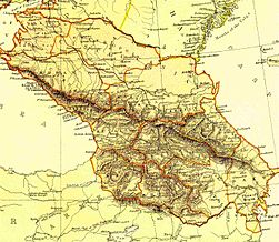
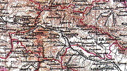
General maps
 | Location map of Georgia |
 | Location map of Georgia |
 | Location map of Georgia |
 | Location map of Georgia |
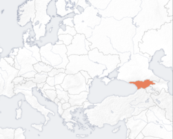
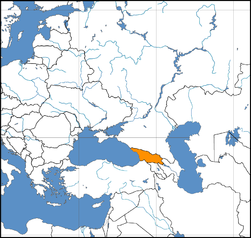
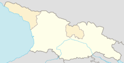
 | Location of Georgia in the Caucasus |
| [[|border|251x400px]] | Location of Georgia in the Caucasus |
 | Location of Georgia in the Caucasus |
 | Location of Georgia in the Caucasus |
 | Location of Georgia in the Caucasus |
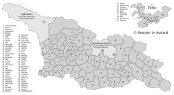
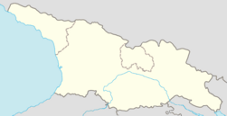
 | Map of Georgia |
 | Map of Georgia |
 | Map of Georgia |
 | Map of Georgia |
| [[|border|251x400px]] | Map of Georgia |
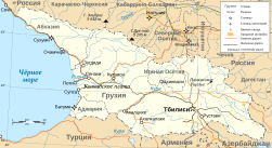 | Map of Georgia |
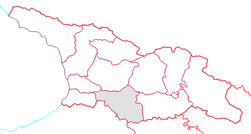
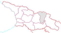
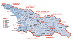 | Regions of Georgia |
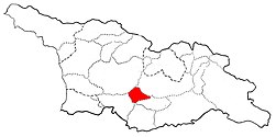
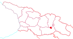
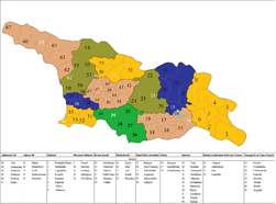 | Districts of Georgia |
 | Districts of Georgia |
 | Districts of Georgia |
 | Main cities and towns in Georgia |
 | Flag map of Georgia |
 | Flag map of Georgia |
History maps
This section holds a short summary of the history of the area of present-day Georgia, illustrated with maps, including historical maps of former countries and empires that included present-day Georgia.
| [[|border|251x400px]] | Caucacus 2000-600 BC and state of Colchis |
 | Urartu at its greatest extent in the time of Sarduris II, 743 BC and state of Colchis |
 | Early Georgian states |
| [[|border|251x400px]] | Early Georgian states 600-150 BC |
| [[|border|251x400px]] | Early Georgian states 600-150 BC |
| [[|border|251x400px]] | Iberia from 600 BC to 500 AD |
 | Colchis in the 6th century BC |
 | Iberia from 500 BC to 350 AD |
 | Early Georgian states in the second century BC |
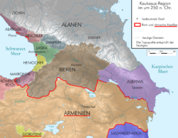
| [[|border|251x400px]] | The Region 189-63 BC |
| [[|border|251x400px]] | Early Georgian states 150 BC-600 AD |
| [[|border|251x400px]] | Early Georgian states 150 BC-600 AD |
 | Georgian states in 100 |
 | Georgian states in 200 |
 | Georgian states in 250 |
 | Georgian states in 300 |
 | Georgian states in 350 |
 | Kingdom of Lazika |
 | Georgian states in 385 |
| [[|border|251x400px]] | Georgian states, 4th-6th century |
 | Georgian states in 565 |
 | Roman-Persian frontier and state of Lazika in 565 |
 | Georgian lands in the late Antiquity and early Middle Ages |
 | Indo-Sassanide Empire |
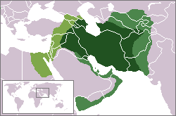 | The Persian Sassanian Empire (226-650) in 602 to 629, Strokes: Under Sassanid military control. |
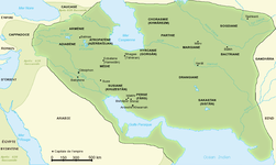 | Sassanide Empire |
 | Sassanide Empire |
 | Georgian states in 650 |
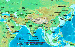
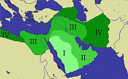 | Expansion of the Caliphate: I: Muhammad; II: Abu Bakr; III: Omar and IV: Othman |
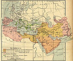 | Caliphate around 750 |
 | Georgian states in 750 |
| [[|border|251x400px]] | Georgian states in 830-1020 |
| [[|border|251x400px]] | Georgian states in 830-1020 |
 | Georgian states in 830-1020 |
 | Georgian states in 850 |
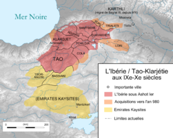 | Iberia in the 9th-10th century |
 | Georgian states in 900 |
 | Georgian states in 1000 |
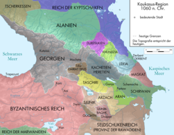 | Georgian states in 1060 |
 | Georgian states in 1090 |
 | Georgia in 1090-1124 |
| [[|border|251x400px]] | Georgia in 1089-1125 |
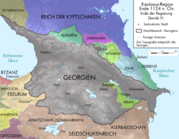 | Georgia in 1124 |
 | Georgia in the 12th century |
 | Kingdom of Georgia at the peak of her might, 1184-1225 |
 | Georgia in 1200 |
| [[|border|251x400px]] | Georgia in 1200 |
This file has annotations. Move the mouse pointer over the image to see them.
| Map showing changes in borders of the Mongol Empire from founding by Genghis Khan in 1206, Genghis Khan's death in 1227 to the rule of Kublai Khan (1260–1294). (Uses modern day borders)
Mongol Empire
By 1294 the empire had split into:
|
| [[|border|251x400px]] | Georgia in the aftermath of the Mongolian invasion, 1220-1245 |
 | Georgia in 1314-1346 |
| [[|border|251x400px]] | Georgia 1450-1500 |
| [[|border|251x400px]] | Georgia 1450-1515 |
| [[|border|251x400px]] | Georgia 1500-1555 |
| [[|border|251x400px]] | Georgia in the late 16th century |
| [[|border|251x400px]] | Georgia in 1762 |
 | Georgia is conquered in 1800-1812 by the Russian Empire. This map shows the Russian expansion from 1533 to 1896 |
 | Treaty of Gulistan in 1813 |
 | Russian conquest of Caucasus, 1801-1878 |
 | Territory of present-day Georgia in the early 19th century |
 | Territory of present-day Georgia in the early 19th century |
 | History of the Russian Empire (in German) |
 | Administrative division of Russia 1848-1878 (in Russian) |
 | Russian Caucasus in 1878-1914 |
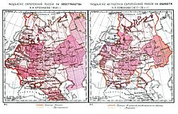
 | Russian provinces in Caucasus, 19th-20th century |
 | Gubernia of Tiflis, 19th-20th century |
 | Gubernia of Kutaisi, 19th-20th century |
 | Oblast Batumi, 19th-20th century |
 | The Russian Empire in 1914 |
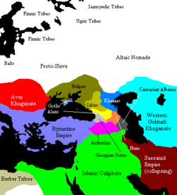
 | Caucasus in 1918 |
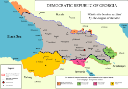
| [[|border|251x400px]] | Democratic Republic of Georgia 1918-1920 |
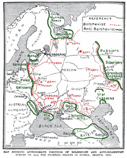 | Frontlines in March, 1919 |
 | Georgia in July, 1920 |
 | Georgia in December, 1920 |
 | Georgia until March, 1921 |
 | Georgia in March-July, 1921 |
 | Democratic Republic of Georgia in May, 1921 |
| [[|border|251x400px]] | Soviet invasion of Georgia, 1921 |
 | European part of the USSR in the 1920s |
| [[|border|251x400px]] | Territorial losses during Sovietization 1921-1931 |
 | Georgian Soviet Socialist Republic in 1922 |
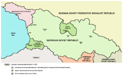 | Georgian Soviet Socialist Republic in 1922 |
 | Evolution of the Soviet Union |
This file has annotations. Move the mouse pointer over the image to see them.
| The republics of the USSR |
| [[|border|251x400px]] | Map of the 1974 geographic location of various ethnic groups within the Soviet Union |
 | Soviet Union administrative divisions, 1989 |
 | The Soviet Union |
 | Location of Georgia in the Soviet Union |
 | Georgian Soviet Socialist Republic in 1957-1991 |
 | Georgian Soviet Socialist Republic in 1957-1991 |
| [[|border|251x400px]] | Conflicts in Georgia 1989-2004, By Dr Andrew Andersen |
 | Conflict in Georgia in 1993 |
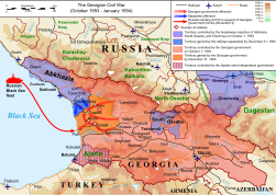 | Conflict in Georgia in 1993 |
 | Situation before the conflict in Georgia in 2008 |
 | Situation before the conflict in Georgia in 2008 |
 | Georgian-Abkhaz conflict zone in June 2008 |
 | Conflict in Georgia in 2008 |
 | Conflict in Georgia in 2008 |
 | Conflict in Georgia in 2008 |
 | Conflict in Georgia in 2008 |
 | Conflict in Georgia in 2008 |
 | Conflict in Georgia in 2008 |
 | Russian bombing during the conflict in Georgia in 2008 |
| [[|border|251x400px]] | Naval activities during the conflict in Georgia in 2008 |
Old maps
This section holds copies of original general maps more than 70 years old.
 | Colchis and Iberia in ancient Caucasus |
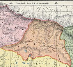 | Iberia in ancient Caucasus |
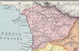 | Colchis in ancient Caucasus |
 | Colchis and Iberia in ancient Caucasus |
 | Colchis and Iberia in ancient Caucasus |
 | Colchis and Iberia in ancient Caucasus |
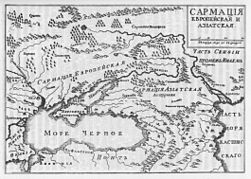 | Colchis and Iberia in ancient Caucasus |
 | Colchis and Iberia in ancient Caucasus |
 | Colchis and Iberia in ancient Caucasus |
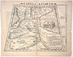 | Colchis and Iberia in ancient Caucasus |
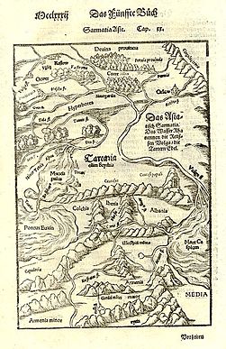 | Colchis and Iberia in ancient Caucasus |
 | Caucasus in 1700 |
This file has annotations. Move the mouse pointer over the image to see them.
| Georgia in 1784 |
 | Caucasus in 1833 |
| [[|border|251x400px]] | Caucasus in 1835 |
 | Caucasus in 1856 |
 | Caucasus in 1882 |
 | Gubernia of Kutais in 1890-1906 |
 | Tiflis Governorate in 1890-1906 |
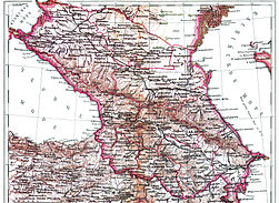 | Caucasus in 1890-1907 |
 | Tiflis Governorate in 1900 |
 | Kutaisi Governorate in 1900 |
 | Western Georgia in 1900 |
 | Etnographic map of the Gubernia of Kutais in 1902 |
 | Etnographic map of the Governorate of Tiflis in 1902 |
 | Etnographic map of the Governorate of Tiflis in 1902 |
 | Caucasus in 1902 |
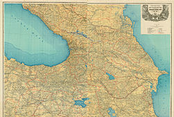 | Caucasus in 1903 |
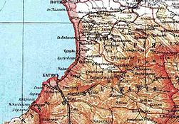 | Guria and Ajaria in 1906 |
Separatism in Georgia
 | Map of Georgia |
 | Map of Georgia |
 | Map of Georgia |
 | Map of Georgia |
 | Map of Georgia |
 | Map of Georgia |
 | Map of Georgia |
 | Map of Georgia |
 | Map of Georgia |
 | Map of Georgia |
 | Map of Georgia |
 | Map of Georgia |
 | Map of Georgia |
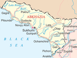 | Map of Abkhazia |
 | Map of Abkhazia |
 | Map of Abkhazia |
 | Detailed map of South Ossetia |
Maps of regions of Georgia
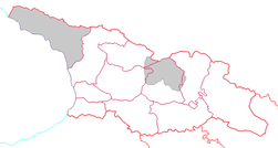
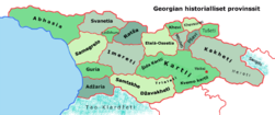 | Regions of Georgia |
 | Regions of Georgia |
 | Eastern Georgia |
 | Map of Adjara |
 | Guria region |
 | Guria region |
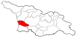
 | Samegrelo-Zemo Svaneti region |
 | Samegrelo region |
 | Zemo Svaneti region |
 | Racha-Lechkhumi and Kvemo Svaneti region |
 | Kvemo Svaneti region |
 | Lechkhumi region |
 | Racha region |
 | Imereti region |
 | Imereti region |
 | Imereti region |
 | Zestaponi region |
 | Samtskhe-Javakheti region |
 | Tori region |
 | Kartli region |
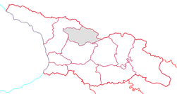
 | Shida Kartli region |
 | Shida Kartli region |
 | Kvemo Kartli region |
 | Kvemo Kartli region |
 | Tbilisi region |
 | Tbilisi region |
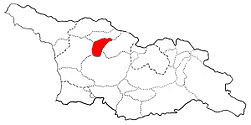
 | Mtskheta Mtianeti region |
 | Mtskheta Mtianeti region |
 | Mtiuleti region |
 | Pkhovi region |
 | Khevsureti region |
 | Ertso-Tianeti region |
 | Kakheti region |
 | Kakheti region |
 | Tusheti region |
Ethnic, linguistic and religious maps
 | Ethnic groups in Georgia |
 | Ethnic groups in Georgia |
 | Ethnic Georgians in Georgia |
 | Ethnic Ossetians in Georgia |
 | Ethnic Kists in Georgia |
 | Ethnic Bats in Georgia |
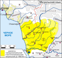 | Mingrelian language in Georgia |
 | Religion in Georgia |
Other maps
 | Major Defence Industry Facilities in Georgia |
 | Pipelines in Georgia |
 | Railways in Georgia |
 | Railways in Georgia |
 | Baku-Tbilisi-Kars railway |

.svg)


-fr.svg)


.svg)


.jpg)


.jpg)


.svg)


.png)


.png)


No hay comentarios:
Publicar un comentario